V sobotu 2. listopadu proběhla mohutná oslava naší plnoletosti !!
Multimediaexpo.cz je již 18 let na českém internetu !!
V tiskové zprávě k 18. narozeninám brzy najdete nové a zásadní informace.
Multimediaexpo.cz je již 18 let na českém internetu !!
V tiskové zprávě k 18. narozeninám brzy najdete nové a zásadní informace.
Soubor:Seto-Inland-Sea-Photo.jpg
Z Multimediaexpo.cz

Velikost tohoto náhledu je: 800 × 565 pixelů
Obrázek ve vyšším rozlišení (rozměr: 1 700 × 1 200 pixelů, velikost souboru: 945 kB, MIME typ: image/jpeg)
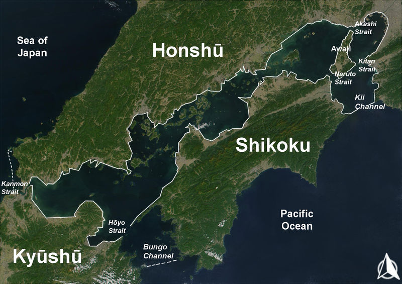
Fotografie + English: The Range of the Seto Inland Sea by the Territorial Sea Law (領海及び接続水域に関する法律) is 19,700 km2 (solid lines). Reference: Seto_Inland_Sea01.png . The Range of the Seto Inland Sea according to the Setouchi Law and the Setouchi Law Enforcement Order is 21,827 km2 (solid lines and dashed lines). Reference: Seto_Inland_Sea02.png.
- Español: Mar interior de Seto. Extensión del Mar Interior
- Date: 18 November 2004
- Source: Based on a Public-Domain-Satellite photo of NASA
- Author: User:Guenny (Christian Günther) made this map of the Japanese Inland Sea (Setonaikai,瀬戸内海) for the German Wikipedia.
+ pochází z Wikimedia Commons, kde má status – Permission is granted to copy, distribute and/or modify this document under the terms of the GNU Free Documentation License, Version 1.2 or any later version published by the Free Software Foundation; with no Invariant Sections, no Front-Cover Texts, and no Back-Cover Texts.
Historie souboru
Kliknutím na datum a čas se zobrazí tehdejší verze souboru.
| Datum a čas | Náhled | Rozměry | Uživatel | Komentář | |
|---|---|---|---|---|---|
| současná | 7. 11. 2021, 13:07 |  | 1 700×1 200 (945 kB) | Sysop (diskuse | příspěvky) | (Fotografie + English: (Taken on May 9, 2012, Nikon D300) * Author: + pochází z Flickr.com , kde má status – Creative Commons FLICKR – Kategorie:CC fotografie Kategorie:Uživatelé FLICKRu) |
- Editovat tento soubor v externím programu (Více informací najdete v nápovědě pro nastavení.)
Odkazy na soubor
Na soubor odkazuje tato stránka:
