The English encyclopedia Allmultimedia.org will be launched in two phases.
The final launch of the Allmultimedia.org will take place on February 24, 2026
(shortly after the 2026 Winter Olympics).
Dovolená : 23. prosinec 2025 — 29. prosinec 2025
Holidays : December 23, 2025 — December 29, 2025
The final launch of the Allmultimedia.org will take place on February 24, 2026
(shortly after the 2026 Winter Olympics).
Dovolená : 23. prosinec 2025 — 29. prosinec 2025
Holidays : December 23, 2025 — December 29, 2025
Soubor:Pluto-map-hs-2010-06-c180.jpg
Z Multimediaexpo.cz
Velikost tohoto náhledu je: 600 × 600 pixelů
Obrázek ve vyšším rozlišení (rozměr: 1 200 × 1 200 pixelů, velikost souboru: 195 kB, MIME typ: image/jpeg)
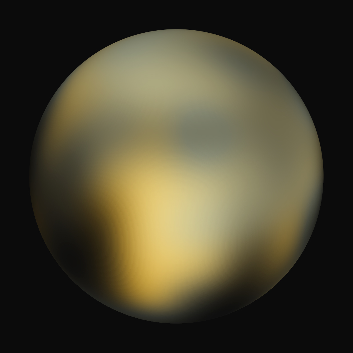
Obrázek + English: A best-fit color image/map of Pluto generated with the Hubble Space Telescope and advanced computers. It is unknown if the brightness differences are mountains, craters, or polar caps.
- Date: 4 February 2010
- Source: Hubblesite STScI-2010-06 (New Hubble Maps of Pluto Show Surface Changes; 180 degree Longitude)
- Author: NASA, ESA, and Marc W. Buie (Southwest Research Institute)
+ pochází z Wikimedia Commons, kde má status – This file is in the public domain because it was solely created by NASA. NASA copyright policy states that "NASA material is not protected by copyright unless noted".
Historie souboru
Kliknutím na datum a čas se zobrazí tehdejší verze souboru.
| Datum a čas | Náhled | Rozměry | Uživatel | Komentář | |
|---|---|---|---|---|---|
| současná | 9. 4. 2014, 13:15 | | 1 200×1 200 (195 kB) | Sysop (diskuse | příspěvky) | (MW1.15-Fotografie) |
- Editovat tento soubor v externím programu (Více informací najdete v nápovědě pro nastavení.)
Odkazy na soubor
Na tento soubor neodkazuje žádná stránka.


